AGRICULTURE

Precision in construction starts with you—the surveyor. Accurate positioning, precise measurements, and seamless data flow lay the foundation for successful projects. With construction surveying technology from Leica Geosystems, part of Hexagon, you can shape construction by driving efficiency, reducing risk, and ensuring quality from the ground up.
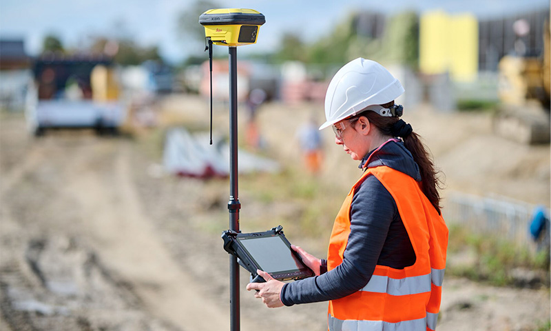
From the evolution of theodolites to total stations and miniaturised laser scanners, surveying has been in our DNA—for over 200 years; with all our innovations, we aim to increase productivity, improve workflows and provide high-quality results. As a surveyor, you play a crucial role in digitalising construction, ensuring that every stake, measurement, and verification keeps the project on track. To make your work more efficient, we are here to support you with accurate tools, sophisticated software, and trusted services – with close to 300 service centres in more than 80 countries.
With the right technology, you can deliver results faster while maintaining the highest standards of accuracy. Leica Geosystems solutions help you:
By adding these technologies to your toolbox and integrating BIM data directly into the field, you can conduct on-site quality checks, streamline verification processes, and create highly accurate as-built documentation shared in real time with all stakeholders. Leica Geosystems provides reality capture and geospatial solutions that empower you to be the digital leader on every construction site.
As a construction surveyor, you are more than just a data collector—you are a data manager. By digitalising the construction life cycle, you can deliver quality services throughout all stages of construction, complete projects faster with less waste and rework and be more profitable. Our hardware and software solutions make field and office work easier and enable the digitalisation of workflows and dataflows. The solutions empower you to be the data manager by enabling smart collaboration, sharing progress and recording assets. Speed up BIM-to-field and field-to-office data collaboration, document progress, monitor built-to-plan validation and more. We provide reality capture and surveying equipment to detect deviations or differences from design in real-time on-site, keeping your project on schedule and on plan.
Visit us at bauma 2025 to discover first-hand how our construction surveying technology is shaping the future of the industry and helping you to become the data manager. Speak with our experts to learn more about:
Speak with the experts on-site to understand the true partnership we provide. Our job as your reliable partner is to cover all the angles, provide quick and easy communication between site personnel and skilled experts, keep you and your products up to date, understand the issues and anticipate your needs.
Book an appointment on-site and get a free ticket for the construction event of the year. We look forward to welcoming you in hall A2, booth 137.
Achieve unmatched accuracy, flexibility, and efficiency.
Turning data into useful insights for decision-making with cutting-edge technology.
Foster a safety-oriented culture with solutions that integrate with machine control.
Detecting and mapping underground utilities is critical to your construction projects.
Turning your geospatial data into 2D drafts, 3D BIM models, and mechanical design.
Enhance accuracy and efficiency in every job with intuitive machine control solutions.